Thermal Waters Route
- Signage:

-
Difficulty:


- Length:
 9 miles
 - Slope: Positive 167 ft
- Type of activity:

- Typology: Linear
- Duration:
 By bike: 1 hour - On foot: 3 hours and 45 minutes
Connect with the green road
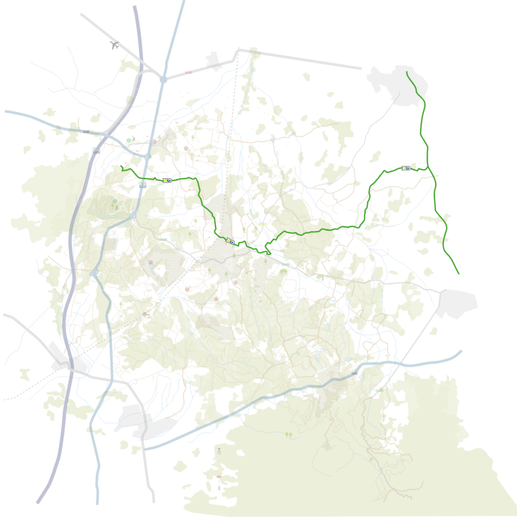
The Thermal Waters Green Road crosses areas of great landscape and social importance: agricultural fields, farms, dense forests, hot spring sources, and connects three essential historic roads of communication: the Royal Way, the Carrilet Route and the Barcelona-France railway track.
If we start the route at the meeting point of the Hostal de Franciac, we will have to follow the signs that send us over the A-2 motorway bridge, then following a dirt track, the Royal Way, in front of the old Hostal la Thiona until we reach the Creu de la Mà.
The first section of the route follows the golf roads until its exit, where will be parallel to the A-2 service road up to a point where we will cross and will take the Can Català way, after hard ascent. Once up, we turn left, passing in front of Can Gelada, and shortly after we turn right to go into the forest mass known as the Can Català Forest, exiting at the agricultural fields of Can Solà del Bosc. We will cross the Can Solà ravine via a concrete stepping-stone and will find a magnificent open area of fields with some lovely views of the main topography of the Selva plain, Guilleries mountain range and Montseny Massif. We will follow the route, leaving on the left the ruins of the old Can Solà del Bosc farmhouse. We continue along the path, passing in front of Can Camps and entering the Cal Teixidor forest until we find the paved path that connects Caldes centre with the Can Solà I urban development. We follow it in the direction of the centre up to avenida Doctor Furest, after crossing below the train tracks. Having arrived at this point, we have the station 984 feet to the left, where we can find totem poles and information panels. If we want to continue on the route, we will take a detour to the right, passing in front of Vichy Catalan Thermal Spa, following the same avenue up to plaza de Sant Esteve, where we will find shops and Prats Thermal Spa. Following the facade of the Prats Thermal Spa, ascending calle Pla i Daniel, we will arrive at the monument of national interest the Sant Grau Hill Roman Thermal Baths. On this hill, we find two sources of thermal water, the Bullidors and the Sant Narcís hot spring sources. Taking the street on the right, calle de las Termes Romanes, and following the signs, we will arrive at calle Trasmuralla, where we will see on a ravine on the right, La Mina hot springs source and the municipal thermal water washing places. Following this street, we will arrive at Las Moleres Park, with a fountain, picnic tables, a play area, a basketball court and a natural health and fitness park. From here, we take the paved path that connects the centre, the municipal cemetery and the Aigües Bones urban development. We pass the streets of the urban development up to a point where we cross, very carefully, the Caldes to Llagostera road (GI-674). We take the Can Riurans Way, crossing rambla Benaula via a low concrete passage and continue on the path through the fields that make up the Benaula plain. Right after crossing a small canal called Rec Madral and next to a farmhouse known as Ca l’Artau, we need to take a path on the right that goes inside a forest known as La Sureda. This way is known as the Cassà de la Selva Way. The outline crosses this dense dark forest, passing through a clearing that is a little more open. We will find different crossroads, like the Sureda Way and the historic old Gerona to Tossa Way (Sant Andreu Salou to Llagostera Way). At this point, we will leave on the right a descending path that corresponds to the Benaula Route and the Hermitage Route, and will continue straight on through the same forest, next to some fields until we exit at Can Masgrau and arrive at a crossroads, which we will take on the left. We will follow the path until we arrive at a detour that we will take again on the left and will continue in a northerly direction along the Sant Vicenç d’Esclet Way. This section goes through the flat part of rambla Gotarra, which we will cross via a low concrete passage. We will enter an area full of fields, cross a first canal and right after will cross rambla Cagarella via a corridor. This boulevard coincides with the boundary of Caldes municipality with Cassà de la Selva and is the entrance to the Esclet neighbourhood. Following this way, after 1.2 miles, we will find the crossroads of the Carrilet Route, whereby we can arrive, if we want to, at Llagostera/Sant Feliu de Guíxols or at Cassà de la Selva/Gerona.


 By bike: 45 minutes –On foot: 3 h 15 minutes
 7.7 miles
