Hermitage Route
- Signage:

-
Difficulty:


- Length:
 22 miles
 - Slope: Positive 863 ft
- Type of activity:

- Typology: Circular
- Duration:
 8-9 hours
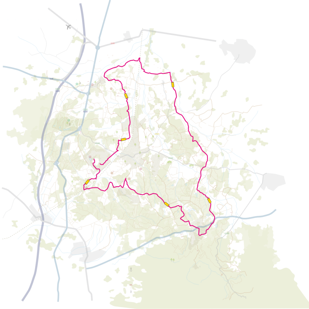
An ideal route for spending the day in the mountain and enjoying the religious architecture and nature. It is a circular itinerary that connects different hermitages, churches and chapels, on a long but rather flat route. At several points on this route, we will find different links with other hiking and mountain biking routes.
It is a circular itinerary that connects different hermitages on a long, but rather flat route. We start the itinerary at plaza del Ayuntamiento, where the Tourist Office is located. From here we go to the train station; a few feet before arriving, we continue along calle de Ponent which allows us to cross the road via a tunnel and find the first vertical sign (banner sign) and the yellow paint markings that will guide us along the route. The path continues along the paved road in the direction of the Can Solà Gros urban development to then continue along the dirt track amidst forests and agricultural fields until arriving at Franciac, where we find the St. Mathew of Franciac Church. At this point, we share the path with the Vía Augusta, which we will leave further on to cross the train track and continue in the direction of the St. Andreu Salou Church. The route continues along the paved road for approximately 1.2 miles, where we find a main road that we have to cross to follow the route along a forest track. We enter the forest area via a path that is very pleasant until we find another main road that we will also have to cross. We continue the itinerary, always following the yellow paint strips, in the direction of the Can Carbonell urban development and gently ascend up to the boundary of the urban development to find the St. Seclina Church, which is in a poor state of preservation. From this point, the route is shared with a section of the Terranegra Way (Caldes de Malavella-Tossa de Mar). We start by descending and then continue until we exit the urban development and, via the forest path, we arrive at the C-35 motorway. We cross the motorway under a bridge and after gently ascending along a forest track, the path, now flat, leads us along a section of the route between forest and agricultural fields up to the St. Maurice Hermitage. We continue along the main track up to a detour (banner signs). Via the track on the right we would return to Caldes, but we take the path on the left, a narrow forest track that we will leave a few feet further ahead. We continue along a section that alternates forest areas and agricultural fields amongst sparsely populated farmhouses. We cross a boulevard and shortly after the train track. After a short section of path, we arrive at the St. Sebastian Chapel, located in a private estate. We return to Caldes along the perimeter of the Llac del Cigne urban development, cross the approach road to the municipality and a few feet further ahead, we find the point where we started the route, next to the bridge that allows us to continue along the road and complete the path up to the town centre.


 2 hours
 5,6 miles